A Condensed History of Byrnes Street, Botany
Botany is a suburb to the south of Sydney toward the end of Botany Road and on the north-eastern side of Botany Bay. It developed from an early fishing community, Booralee Village.
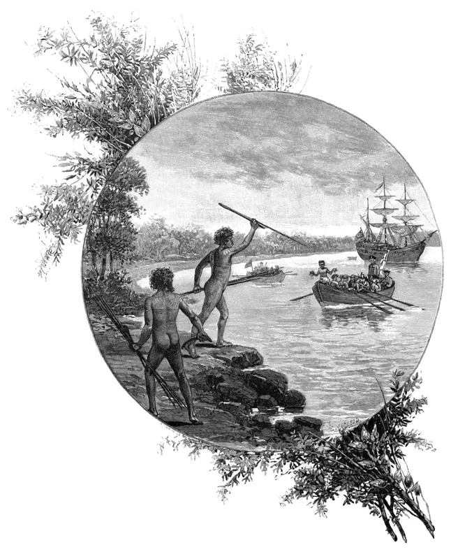
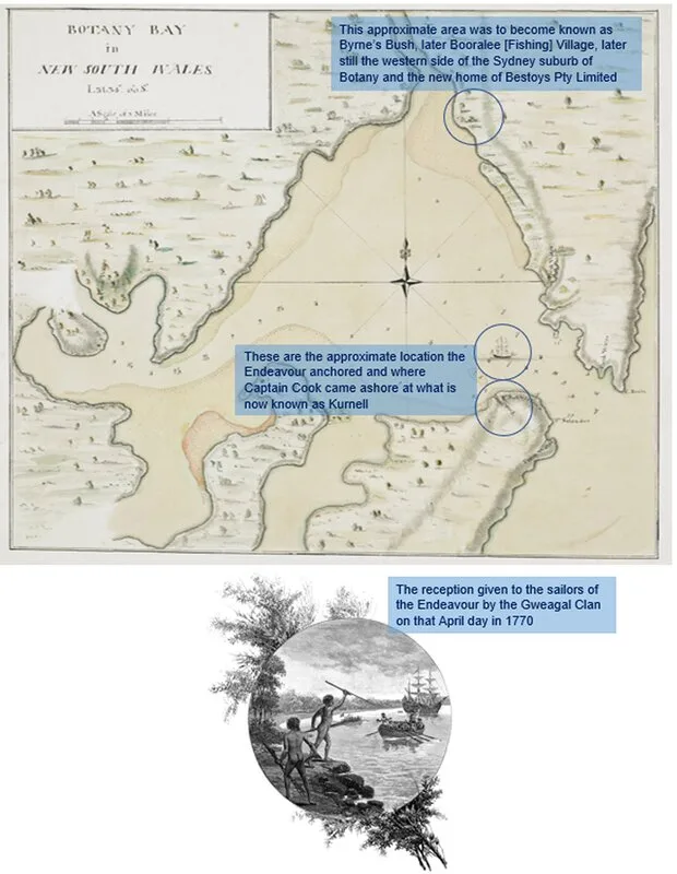
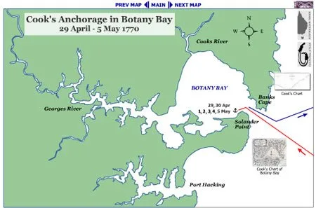
On Sunday 29th April 1770, the Gweagal Clan of the Dharawal people, whose home was the broad area encompassing the coastal Sydney basin, ‘welcomed’ Captain James Cook and the Endeavor near the area now known as Kurnell, on the southern headland of the oceanic embayment they knew as Kamay.
Naming the area for the Admiralty, Captain Cook recorded in his log of 6th May 1770, "The great quantity of these sort of fish [stingrays] found in this place occasioned my giving it the name of Stingrays Harbour". However, in the journal he prepared later from his log, Cook wrote instead: (sic) "The great quantity of plants Mr. Banks and Dr. Solander found in this place occasioned my giving it the name of Botanist [struck out] Botany Bay".
Extensive scouting was carried out by Captain Cook and the scientists and some records indicate that Cook, British Mr. Banks and Swedish Dr Solander did actually set foot on the north-eastern shore where the suburb of Botany would evolve. Cook did mention a freshwater stream that fed into the bay from the north – most likely the river now known as Cooks River.
The American War of Independence (19th April, 1775 to 3rd September, 1783) put paid to the transportation of British convicts there. A new destination was sought.
At the end of January, 1788, British soldiers, settlers and convicts, under the leadership of Captain (later Governor and, later still, Admiral) Arthur Phillip arrived and, by the first decade of the 19th century, much of the land along the rough road leading to Botany Bay had been allocated or sold to these British soldiers, settlers and convicts.
Then political upheaval!
The Rum Rebellion began on 26th January 1808 – coincidentally the 20th anniversary of the founding of the colony – with the arrest and confinement of Governor William Bligh, and ended on 1st January 1810 with the arrival of the new lawful governor, Major-General Lachlan Macquarie.
During the 1-year, 11-months and 6-days of the “Great Rebellion” many land grants and favoured appointments were made first by Lieutenant-Colonel Foveaux, who had returned from England with the appointment of Lieutenant-Governor, and in turn, by Colonel William Patterson, also appointed Lieutenant-Governor.
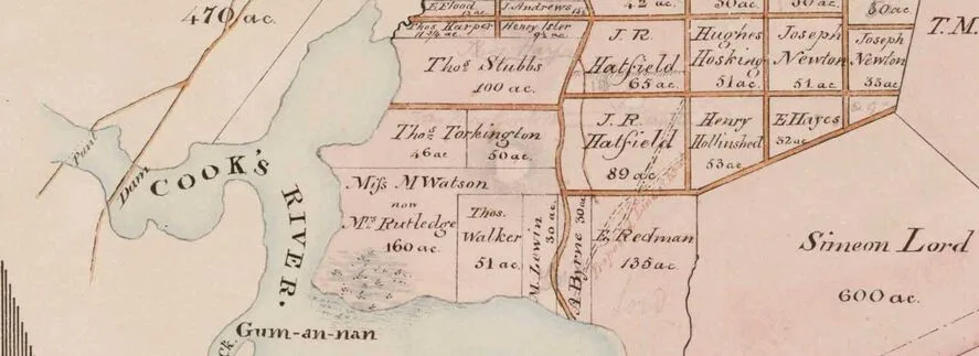
It was during Patterson’s tenure that the first recorded grants of land to Europeans in the Botany Bay area were made and, on 16th September 1809, three ex-convicts received these parcels of land located near today’s Sydney Kingsford-Smith Airport and the mouth of Cooks River:
Edward Redmond – 135 acres – naming his allotment ‘Mudbank’;
Mary Lewin – 30 acres – naming her allotment ‘Newcastle’ and
Andrew Byrne – 30 acres – naming his allotment ‘Sea View’.
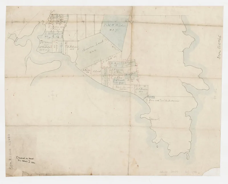
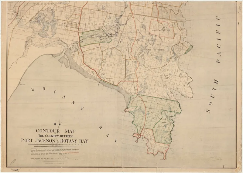
The map below shows the land granted around 1823: Simeon Lord was granted 600 acres of land on 27th May, 1823, the bottom left corner of which would become Booralee Fishing Village which would in turn become Booralee and then the suburb of Botany. The 704 acres below Simeon Lord's parcel was government reserve. Fifty acres of that, adjoining Lord's parcel and fronting the Botany Bay foreshore, would be granted to Andrew Byrne and a rough road running through Lord's parcel to Byrne's would become known as Byrne's Road (sometimes spelt Burns and Byrne, and either road or street).
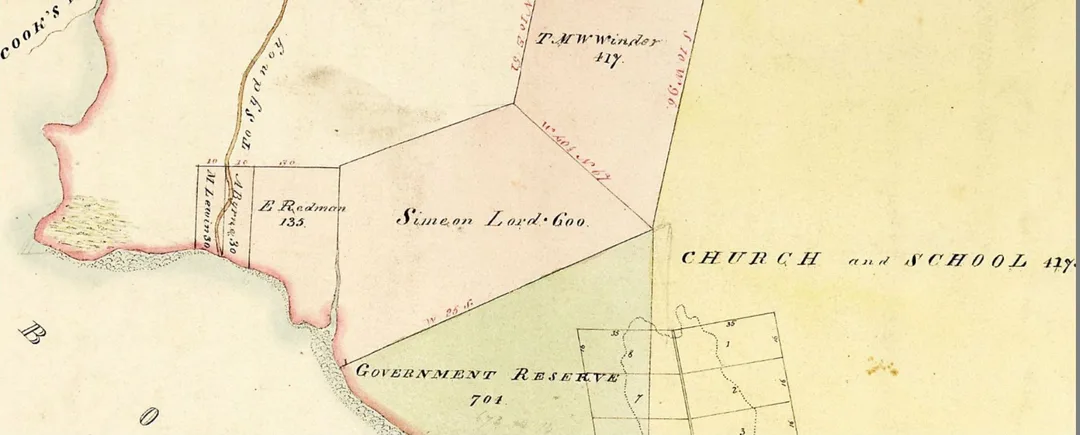
This map, c1823, shows the three parcels of land granted by Colonel Patterson in 1809. The road "To Sydney" was a track that changed in name and course over the years

Barely three months after the 30-acre land grant, when Governor Lachlan Macquarie assumed the Government of the colony on 28th December, 1809, one of his first acts was the issue of a proclamation declaring the King's displeasure at the mutinous proceedings which had taken place. This was speedily followed by another declaring null and void all the acts of the interim Government. Among the many appointments and grants that were voided was the land granted to Andrew Byrne by Colonel Patterson.
However, another source of information, Spurway, John, ed. Australian Biographical and Genealogical Record. Series 1, 1788-1841, with series 2 supplement, 1842-1899. Sydney: A.B.G.R., 1992 states this:
“[Andrew Byrne and Mary Lewin] Granted 30 acres Penrith 6 Sep 1809. On 11 Jan 1810, Andrew and his future wife Mary Lewin each had to surrender their 30 acre land grants at Penrith to Governor Lachlan Macquarie. The grants had been illegally made by a rebel government under Lt Governor Paterson. New land grants of 30 acres each were then reissued to Andrew and Mary at Botany Bay. These farms, known by the names of Sea View and Newcastle, commanded a full view of the ocean between Botany heads and were noted for stock, particularly horses, on account of an extensive salt marsh. They also possessed a good fishery. The farms also bordered the banks of the Cooks River. Andrew received an absolute pardon on 31 Jan 1811 and sold the Botany Bay farms about 1819, together with two sailing sloops, of nine and eleven tons burden, which were used for discharging grain for His Majesty's Stores.”
(In this account, Patterson's grants were 30 acres at Penrith, not Botany, and it was Macquarie who allocated the Botany Bay land to Andrew.)
On 10th September, 1812 Andrew married Mary Lewin at St. Phillips Sydney. They already had 3 children – Thomas (born circa 1802), Owen (born circa 1804) and John (born circa 1808). Sadly, Mary died in 1815 and Andrew later remarried.
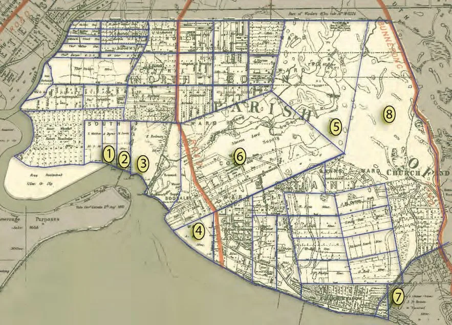
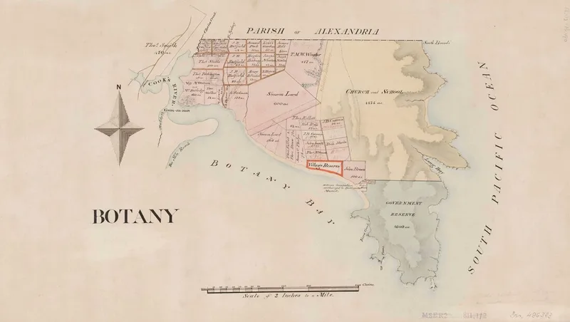
Fig. 4.1.1 Location of the earliest (pre 1830) land grants and land reservation in the Botany district, numbered in order of the grant being promised.
1. 1809 to Andrew Byrne ‘Sea View’ - 30 acres – sold c1819
2. 1809 to Mary Lewin ‘Newcastle’ (30 acres) – sold c1819
3. 1809 to Edward Redmond (‘Johns Town’, a.k.a. ‘Mudbank’(135 acres). Purchased by Simeon Lord 1816.
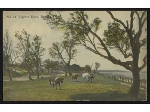
4. 1814 to Andrew Byrne (promised by Governor Macquarie but not confirmed until 1847; backdated to 1827) ‘Castletide’/’Castlehide’/‘Cool Harbour’/’Macquarie Sea View’/ a.k.a. Byrne’s Bush - 50 acres
5. 1822 to Tom White Melville Winder (417 acres as extension to his Lachlan Swamps Estate)
6. 1823 to Simeon Lord (600 acres)
7. 1823 to John Neathway Brown (100 acres, mostly in the Randwick LGA)
8. 1829 to the Trustees of the Clergy and School Estate (1745 acres)
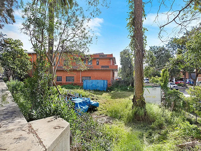
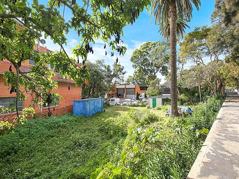
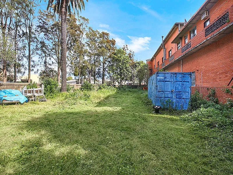
The interesting part of the history of Byrnes Street is that Andrew Byrne didn't actually own the land on which Byrnes Street stood. It was part of Simeon Lord's allotment or purchase. The 'street' started out as a track leading through Lord's allotment to Byrne's allotment and became known as 'Byrne's road'. Eventually, the name of Byrnes Street was retained in part to commemorate Andrew Byrne. (See below for the origin of other street names in the Booralee area.)
Andrew Byrne died on April 22, 1863, aged 89 years, at the residence of his son who kept a public-house in George Street, Haymarket, an occupation which Andrew Byrne followed in his early days in Sydney. He was interred in the old Devonshire Street Cemetery which was demolished to make way for the new Central Railway Station in 1901. The remains of all those interred there from the earliest days of Sydney settlement were either claimed by relatives or removed to the newly established cemetery at La Perouse, now known as Botany Cemetery. It is unclear where Andrew Byrne is finally at rest. (See http://nla.gov.au/nla.news-article168003743 for an interesting article on the Devonshire Street Cemetery written for The Truth on Sunday 7th April, 1901)
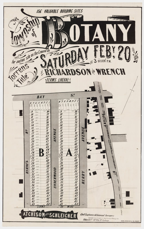
Richardson and Wrench, founded in Sydney in 1858 by Liverpool-born Robert Richardson who set up shop at 235 George Street at the age of 31, advertised "156 valuable building sites [in the] township of Botany." The auction was to take place "on the ground Saturday February 20th, 1886, at 3 o'clock P.M." This was known as the Berry Estate.
The 156-lot subdivision was bounded by Berry Avenue to the east, Byrne's Road to the west with Underwood Avenue running north-south through the middle. The north was hemmed by Bay Street and the southern border by a 20' wide lane, which no longer exists. Each block of land had a frontage of around 24' and was between 92' and 97' deep. On average, each block was about 2,280 square feet or 0.05 acres.
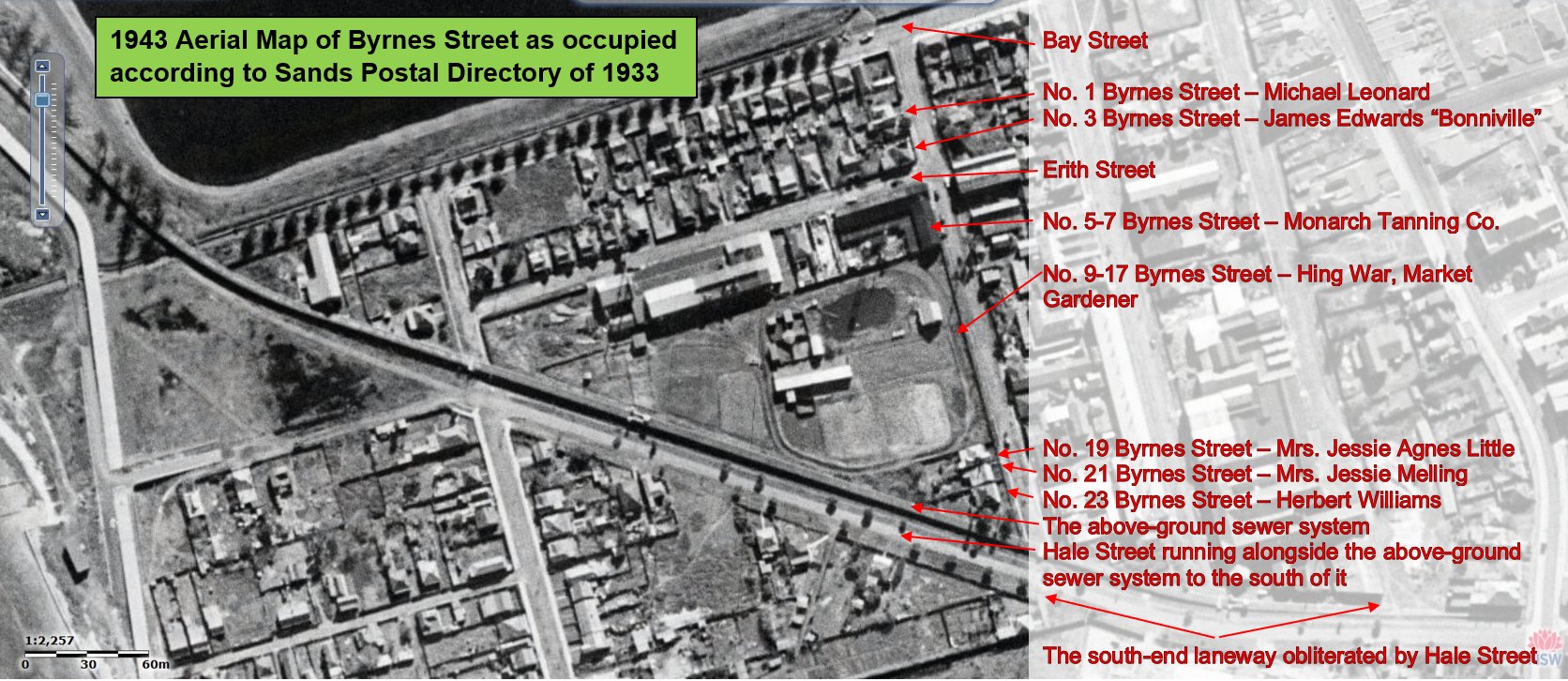
The flyer advertising this subdivision shows the west side of Byrne's Road having only three buildings on it. The building at the north end, opposite blocks numbered 9 and 10, most likely occupied what was to become numbers 1 and 3 Byrnes Street. The earliest Sands Directory of 1891 has Mr. and Mrs. Alfred E. Desbry as the residents of this building.
Next to that building was a lane. This was to become Erith Street.
Then there is a great expanse of land between that laneway and the next building. This was most likely market gardens occupied by John Bullock who was listed in the 1891 Sands Directory as occupying this land as a market gardener until 1903 when tenure was transferred to William A. West. It then passed through several hands until 1924 when Monarch Tanning Co. took over the corner of Erith and Byrnes Streets, occupying lots 5-7.
The market garden continued on the land that would become Lots 9-17 Byrnes Street under the tenancy of Hing War, Market Gardener, from 1930 until at least 1933 when the Sands Postal Directory ceased being printed. Aerial photograph of the area taken in 1943 shows this expanse of land as being mostly unoccupied save for a cottage situated along the street about where No. 11 would be.
Of the remaining two cottages or buildings, the new above-ground sewer would slice diagonally between them and the lower building most likely being demolished.
The above are only suppositions - more research is required...
Richardson and Wrench's 1886 flyer advertising the sale of lots in Botany
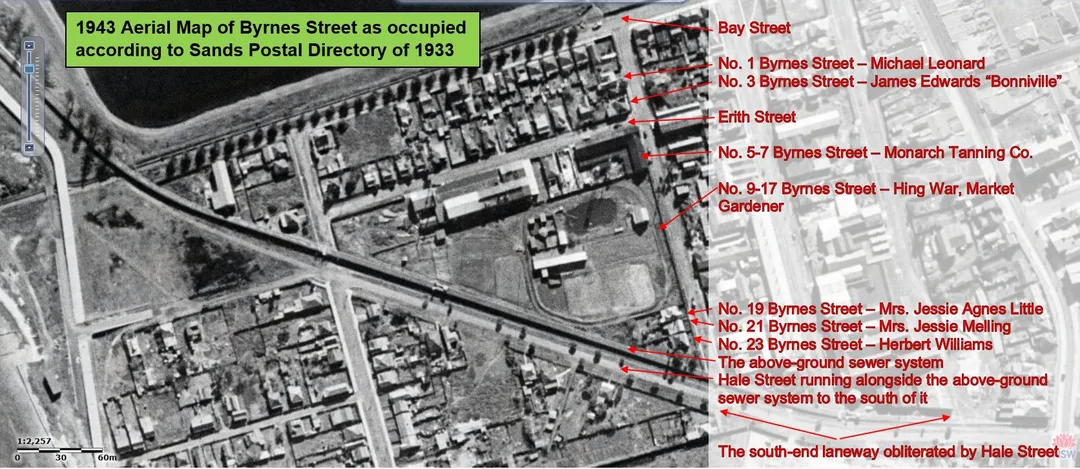
1943 Aerial map of Byrnes Street with 1933 Sands Postal Directory listed occupiers of the lots on the west side of Byrnes Street. No. 19 was occupied by Mrs. Jessie Agnes Little and No. 21 by Mrs. Jessie Melling
The long-established fishing village of Booralee (see this excellent source: Booralee Fishing Town by Joanne Sippel, 2013 - https://dictionaryofsydney.org/entry/booralee_fishing_town) that had evolved at the western end of Bay Street was effectively cut off from its boat moorings and the foreshore by these sewer lines. The remaining fishermen now had to climb stairs over the sewer lines to reach the shore; slowly but increasingly they were being disconnected from the sea. At the same time, the area the fishing town stood on was rezoned industrial and homes were demolished to make way for new factory complexes.
In 1930, the proclamation of Botany Bay as a port of entry for overseas shipping signalled the construction of oil tanker berths at Kurnell – Captain Cook’s original landing place on the southern headland – and the Gweagal Clan’s oceanic embayment that Cook named Botany Bay underwent significant and irreversible development that would become the Port Botany of today.
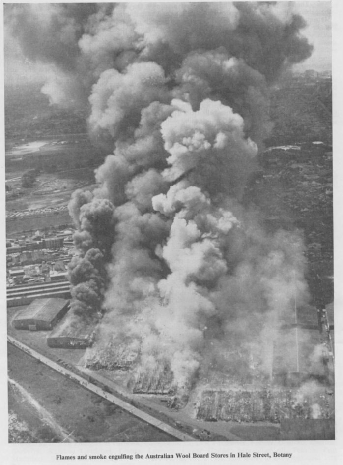
The early 1970s saw further dredging of the bay for a new container port on the eastern shore. There is no indication where the two-storey house Andrew Byrne built stood but it was apparently close to the beach, in Byrne’s Bush and near where Commonwealth Wool Stores were later built. [The Commonwealth Wool Stores on Hale Street, Botany burnt down on Tuesday, 30th September, 1969.] This home stood until 1970 when it was demolished to make way for Foreshore Road, a highway on reclaimed shoreline leading to the new Shipping Terminal to be known as Port Botany. This road also cut off the precinct of Booralee Village from the bay once and for all. The original beachside of the Botany suburb disappeared.
Construction of the Port Botany container terminal began in 1971 and the facility opened in December 1979 by which time the Bonaretti family was well established in the area and the name Bestoys known Australia-wide as the best wooden toys and nursery furniture made in Australia.
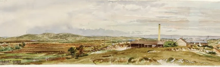
1873 Watercolour of Old Botany Road, looking towards the Bay by Samuel Elyard


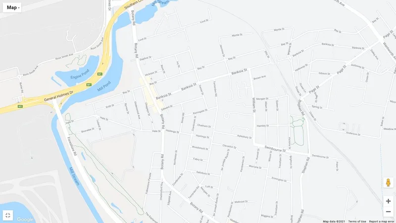
https://www.google.com/maps/d/viewer?mid=14HwRa3Mm5LZHxrIP8OrlpStDVW4&msa=0&ll=-33.94383848089416%2C151.195531304924&z=18
Byrnes Street, Botany, New South Wales
Named after Andrew Byrne an early land grantee. Andrew Byrne was an Irish rebel who arrived in Sydney in 1800. He was granted land by Governor Macquarie - 30 acres adjoining Cooks River and approximately 50 acres adjoining Botany Bay (Byrnes Bush). Many years passed before a Deed was actually issued for Byrne’s Land. It was not until the 4th June, 1847 that the grant was made. It refers to the grant as “Macquarie Sea View” and states that the land was promised on or before the 4th July, 1814. Byrnes Street has been known as Byrne Street, Byrne Road, Burns Street and Burns Road in various documents.
Underwood Avenue, Botany, New South Wales
Probably named after James Underwood, a boat builder in Botany. He was in partnership with Simeon Lord and Henry Kable building boats.
Chegwyn Street, Botany, New South Wales
Named after James Chegwyn (J. Chegwyn & Sons – Tanners). The firm was founded in 1886, by James Chegwyn, who arrived in Sydney in 1870, from Launceston, England. In 1892 Mr. Chegwyn came to Botany and opened up a tannery in Berry Avenue. He built fourteen pits and started tanning dressed leathers. Later, a change to dressing sole leather was made and many more pits added to cope with the large quantity of hides tanned. The street was formerly named Berry Avenue, Botany and renamed in 1961.
Luland Street, Botany, New South Wales
Named after Francis Joseph Luland - Botany Alderman (1888-1910) and Mayor in 1893-1895 and 1903 and 1904 who was a member of the first Botany Council. Mr. Luland was born at Redfern about 1857 to English parents. He joined George Phillips as partner of a tannery opened at Berry Avenue, Botany. After some years the partnership was dissolved, and Mr. Luland carried on business on his own account. He died on 4th December, 1935. When the above-ground sewer was built the northern section of Luland Street was renamed McFall Street.
Hale Street, Botany, New South Wales
Named after William Hale, Botany Alderman - (1901-02, 1909-13, 1915-16) Mayor 1911 and 1912. He was born at Botany on 13th June, 1858 and was the founder of the tannery later known as William Hale and Sons; he commenced operations as a basil tanner at Bunnerong Tannery in 1902. Mr. Hale was interested in many organisations at Botany, amongst which might be mentioned the School Board, and the Botany Cemetery Trust of which he became President in 1911 and held that position until his death on 20th August, 1926. Appointed one of the original trustees of the Royal South Sydney Hospital in 1913.
Bay Street, Botany, New South Wales
Named after Botany Bay. Bay Street originally led to Botany Bay. (Section from near McFall Street to the ocean outfall sewer was closed and sold to the adjoining property owner).
McFall Street, Botany, New South Wales
Named after P.J. McFall - Botany Alderman (1954-62). Formerly part of Luland Street, Botany, before it was cut by the above-ground sewer.
https://australianroyalty.net.au/tree/purnellmccord.ged/individual/I68016/Andrew-Byrne
https://dictionaryofsydney.org/entry/booralee_fishing_town
http://nla.gov.au/nla.news-article168003743 for an interesting article on the Devonshire Street Cemetery written for The Truth on Sunday 7th April, 1901
https://convictrecords.com.au/convicts/byrne/andrew/128811
https://www.wikitree.com/wiki/Byrne-2447
https://www.google.com/url?sa=t&rct=j&q=&esrc=s&source=web&cd=&cad=rja&uact=8&ved=2ahUKEwiOqu72__f9AhVRZd4KHcV-BgQQFnoECCYQAQ&url=https%3A%2F%2Fwww.shirehistory.org%2Fuploads%2F1%2F0%2F9%2F1%2F109164607%2F094_1990_february.pdf&usg=AOvVaw3m-e2bBwIiZoDXgfcOt8aX
https://www.facebook.com/photo/?fbid=3150130035052550&set=the-story-of-andrew-byrne-1779-1863andrew-byrne-was-a-united-irishman-who-hailed
...and many more sites...

An interesting discovery in a house in Byrnes Street...
The photographs linked below were found while researching the history of Byrnes Street on the Australian War Memorial website:
(https://www.awm.gov.au/advanced-search?query=P08997.025&collection=true&facet_type=Photograph&page=2 With sincere thanks to the Australian War Memorial in Canberra for the collection below and information.)
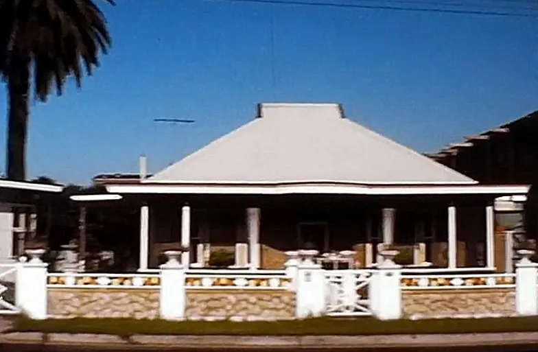
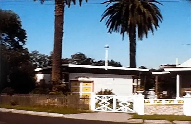
Found in the wall cavity of a residential house in Byrnes Street, Botany when it was demolished in the early 1970s, their discovery gives weight to the supposition that the cottages in this area, and in particular along Byrnes Street, were built between the two World Wars (1919-1939). The styles of the cottages also indicate this time period.
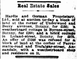
An advertisement placed in the Real Estate Sales section of The Sun (Sydney) on Wednesday 18 December 1918 (Page 7) by Hardie and Gorman Proprietary,
Ltd., advises that a ... "weatherboard cottage in Byrnes-street, Botany, [sold] for £200;" but it does not give a street number nor if it was a recently-built residence. However, a search of the Sands Directories of 1918 and 1919 indicate that only one property in "Byrnes-street" changed hands in that period. This was the piece of land on the corner of Erith Street now numbered 5-17, which William Campbell sold to Arthur Johnson. There may have been a weatherboard cottage on it at the time but, in 1958, 5-7 was occupied by a tannery with other factory buildings on the remaining lots.
In November 1976, the Bonarettis demolished their cottage at number 19 Byrnes Street. Prior to that, the cottage at number 21 had been demolished around 1958 but neither of these had uncovered the cache of photographs listed here. This part of Botany had been rezoned light industrial years before the Bonarettis purchased their lot in 1958, and any residence that was demolished could not be rebuilt as a residence, unless it had burned down. So this meant that as older residents moved on and their homes sold, it was more likely that those lots of land would be turned into factories, warehouses or commercial premises.
When the Bonarettis moved to Byrnes Street, there were very few residences remaining and, of those, all were from the same era and most were occupied by older couples.
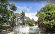
Next to the Bonarettis and on the same side, the western side, number 23 was the last house along the cul-de-sac. It had been extensively remodelled and modernised by the interior designer occupant, Mr. Mark Anthony who lived there with his wife, Alma. They most likely purchased this property around 1955 and lived there until circa 1990 after which it was unoccupied and left to deteriorate. On 3rd December, 1996, the property was sold at auction for $215,500. The once-elegant house was eventually demolished in the late 2010s and in 2020, the cleared land was put up for sale once more, going for $1,450,000 by private treaty. The two Canary Island Date Palms (Phoenix Canariensis) that are on that property are protected and are listed in Botany Local Environmental Plan 1995 – Schedule 3, item 70.
(see http://classic.austlii.edu.au/au/legis/nsw/consol_reg/blep1995297/sch3.html)
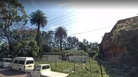
23 Byrnes Street, Botany in 2007 showing the 2 Canary Island Date Palms and no house
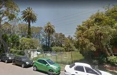
23 Byrnes Street, Botany in 2015 showing the 2 Canary Island Date Palms and no house
23 Byrnes Street, Botany in 2021 showing the 2 Canary Island Date Palms and no house
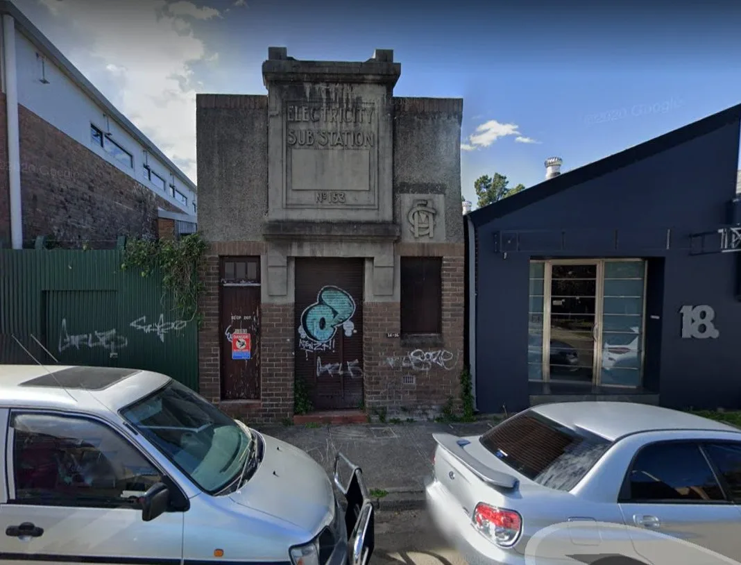
On the opposite eastern side, the only cottages that were there in 1958 were at the southern end of the street, just before the cul-de-sac and numbered from 28 to 36. As with the western side, there may have been cottages all along but, by 1958, they had been replaced by factories and a now heritage-protected Electricity Substation No 153 (Item 69 on the above Environmental Plan) at number 14.
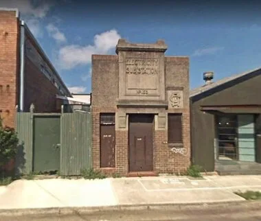
Electricity Substation No 153 at 14 Byrnes Street, Botany in 2007

Electricity Substation No 153 at 14 Byrnes Street, Botany in 2020
(See https://trove.nla.gov.au/newspaper/article/64973339/5405983 for an article dated Saturday, 21st February, 1880 on "Messrs. Enoch Taylor & Co.'s Display of Boots and Shoes at the Garden Palace.")
Number 34 was occupied by Mr. and Mrs. Norman Kenneth Archdeacon who would have been in their mid-60s in 1958. He was a retired watchman and his wife, a dressmaker, continued to work from home. Mr. Archdeacon died on 26th June, 1967 as a result of a fall in his home. Not long after that the house was sold.
Mr. and Mrs. Lee, both in their 70s, lived at number 36, and 38 was occupied by unknown persons. The cottage at 38 burned down around 1975 and rebuilt as a residence however nothing survived the conflagration.
Given that the “photographs were found in the wall cavity of a residential house in Byrnes Street, Botany, Sydney when it was demolished in the early 1970s”, it could be deduced, rightly or wrongly, that the cache may have been stored at 28, 34 or 36 Byrnes Street. The male occupants of those residences may have served in the First World War.

Collection type Photograph
Object type Black & white - Film original negative nitrate other
Maker Unknown
Date made 1915-1918
Conflict First World War, 1914-1918
Copyright Item copyright: Copyright expired - public domain
This item is in the Public Domain
Description
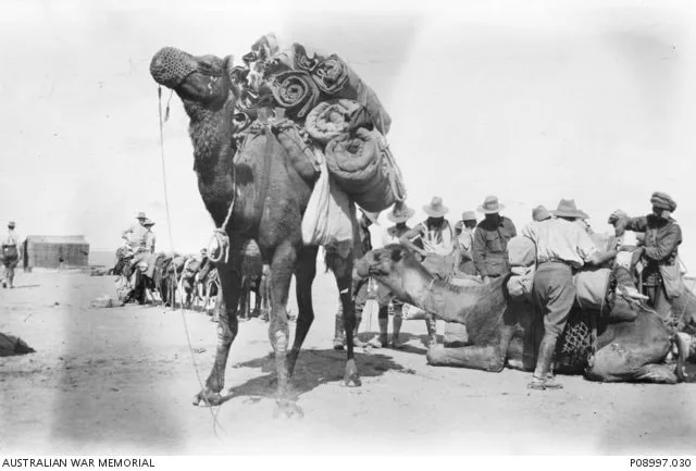
Camels being loaded with supplies. One of a series of photographs relating to an unknown Australian serviceman who undertook motorcycle duties with a signal squadron in Egypt and possibly Palestine during the First World War. The photographs were found in the wall cavity of a residential house in Byrnes Street, Botany, Sydney when it was demolished in the early 1970s.
Here are the links to all of the photographs unearthed:
Collection 28 Results
1. The French Battleship Jaureguiberry at anchor where she acted as a guard ship from 1916 until ... Photograph
Maker: Unknown
The French Battleship Jaureguiberry at anchor where she acted as a guard ship from 1916 until 1919. Her hull is painted a light grey, while the turrets are very dark grey or black. Note the extreme tu...
P08997.025
2. Villagers in Egypt (or possibly Palestine) are engaged to lay wooden supports to assist the ...
Photograph
Maker: Unknown
Villagers in Egypt (or possibly Palestine) are engaged to lay wooden supports to assist the movement of armoured vehicles across the desert. One of a series of photographs relating to an unknown Austr...
P08997.014
3. Portrait of three unidentified Australian servicemen on motorcycles. One of a series of ... Photograph
Maker: Unknown
Portrait of three unidentified Australian servicemen on motorcycles. One of a series of photographs relating to an unknown Australian serviceman who undertook motorcycle duties with a signal squadron ...
P08997.004
4. Camels being loaded with supplies. One of a series of photographs relating to an unknown ... Photograph
Maker: Unknown
Camels being loaded with supplies. One of a series of photographs relating to an unknown Australian serviceman who undertook motorcycle duties with a signal squadron in Egypt and possibly Palestine du...
P08997.030
5. AIF personnel pose in front of a cistern for either grain or water in Egypt or Palestine. One of ... Photograph
Maker: Unknown
AIF personnel pose in front of a cistern for either grain or water in Egypt or Palestine. One of a series of photographs relating to an unknown Australian serviceman who undertook motorcycle duties wi...
P08997.020
6. Portrait of an unidentified Australian serviceman holding a model aircraft. One of a series of ... Photograph
Maker: Unknown
Portrait of an unidentified Australian serviceman holding a model aircraft. One of a series of photographs relating to an unknown Australian serviceman who undertook motorcycle duties with a signal sq...
P08997.010
7. Villagers in Egypt (or possibly Palestine) are engaged to lay wooden supports to assist the ... Photograph
Maker: Unknown
Villagers in Egypt (or possibly Palestine) are engaged to lay wooden supports to assist the movement of armoured vehicles across the desert. One of a series of photographs relating to an unknown Austr...
P08997.017
8. Hotel de Siam menu. One of a series of photographs relating to an unknown Australian serviceman ... Photograph
Maker: Unknown
Hotel de Siam menu. One of a series of photographs relating to an unknown Australian serviceman who undertook motorcycle duties with a signal squadron in Egypt and possibly Palestine during the First ...
P08997.007
9. AIF personnel are outrun by their mascot, a Dachshund, during a camel race. One of a series of ... Photograph
Maker: Unknown
AIF personnel are outrun by their mascot, a Dachshund, during a camel race. One of a series of photographs relating to an unknown Australian serviceman who undertook motorcycle duties with a signal sq...
P08997.029
10. Portrait of two unidentified British servicemen in a light car equipped with a Vickers machine ... Photograph
Maker: Unknown
Portrait of two unidentified British servicemen in a light car equipped with a Vickers machine gun. One of a series of photographs relating to an unknown Australian serviceman who undertook motorcycle...
P08997.003
11. Possibly a member of No. 1 Australian Light Car Patrol. One of a series of photographs relating ... Photograph
Maker: Unknown
Possibly a member of No. 1 Australian Light Car Patrol. One of a series of photographs relating to an unknown Australian serviceman who undertook motorcycle duties with a signal squadron in Egypt and...
P08997.024
12. Portrait of an unidentified Australian serviceman on a motorcycle. One of a series of photographs ... Photograph
Maker: Unknown
Portrait of an unidentified Australian serviceman on a motorcycle. One of a series of photographs relating to an unknown Australian serviceman who undertook motorcycle duties with a signal squadron in...
P08997.028
13. AIF personnel set off smoke grenades at a signal station in Egypt or Palestine. One of a series ... Photograph
Maker: Unknown
AIF personnel set off smoke grenades at a signal station in Egypt or Palestine. One of a series of photographs relating to an unknown Australian serviceman who undertook motorcycle duties with a signa...
P08997.018
14. Informal portrait of an unidentified Australian serviceman, possibly 1712 Sergeant (Sgt) Donald ... Photograph
Maker: Unknown
Informal portrait of an unidentified Australian serviceman, possibly 1712 Sergeant (Sgt) Donald Gordon MacAlpine, 4th Australian Signal Troop, of Botany, NSW. One of a series of photographs relating t...
P08997.008
15. AIF personnel set off smoke grenades at a signal station in Egypt or Palestine. One of a series ... Photograph
Maker: Unknown
AIF personnel set off smoke grenades at a signal station in Egypt or Palestine. One of a series of photographs relating to an unknown Australian serviceman who undertook motorcycle duties with a signa...
P08997.019
16. Portrait of an unidentified Australian serviceman. One of a series of photographs relating to an ... Photograph
Maker: Unknown
Portrait of an unidentified Australian serviceman. One of a series of photographs relating to an unknown Australian serviceman who undertook motorcycle duties with a signal squadron in Egypt and possi...
P08997.009
17. Villagers in Egypt (or possibly Palestine) are engaged to lay wooden supports to assist the ... Photograph
Maker: Unknown
Villagers in Egypt (or possibly Palestine) are engaged to lay wooden supports to assist the movement of armoured vehicles across the desert. One of a series of photographs relating to an unknown Austr...
P08997.016
18. Portrait of an unknown Australian serviceman. One of a series of photographs relating to an ... Photograph
Maker: Unknown
Portrait of an unknown Australian serviceman. One of a series of photographs relating to an unknown Australian serviceman who undertook motorcycle duties with a signal squadron in Egypt and possibly P...
P08997.006
19. Wagons in Egypt/Palestine. One of a series of photographs relating to an unknown Australian ... Photograph
Maker: Unknown
Wagons in Egypt/Palestine. One of a series of photographs relating to an unknown Australian serviceman who undertook motorcycle duties with a signal squadron in Egypt and possibly Palestine during the...
P08997.021
20. Informal group portrait of unidentified Australian servicemen holding cameras. One of a series of ... Photograph
Maker: Unknown
Informal group portrait of unidentified Australian servicemen holding cameras. One of a series of photographs relating to an unknown Australian serviceman who undertook motorcycle duties with a signal...
P08997.011
21. Informal portrait of an unidentified Australian serviceman. One of a series of photographs ... Photograph
Maker: Unknown
Informal portrait of an unidentified Australian serviceman. One of a series of photographs relating to an unknown Australian serviceman who undertook motorcycle duties with a signal squadron in Egypt ...
P08997.001
22. Informal group portrait of unidentified Australian servicemen. One of a series of photographs ... Photograph
Maker: Unknown
Informal group portrait of unidentified Australian servicemen. One of a series of photographs relating to an unknown Australian serviceman who undertook motorcycle duties with a signal squadron in Egy...
P08997.022
23. Informal portrait of an unidentified Australian serviceman repairing his motorbike in Egypt or ... Photograph
Maker: Unknown
Informal portrait of an unidentified Australian serviceman repairing his motorbike in Egypt or Palestine during the First World War. One of a series of photographs relating to an unknown Australian se...
P08997.012
24. Portrait of an unknown Australian serviceman on a motorcycle. One of a series of photographs ... Photograph
Maker: Unknown
Portrait of an unknown Australian serviceman on a motorcycle. One of a series of photographs relating to an unknown Australian serviceman who undertook motorcycle duties with a signal squadron in Egyp...
P08997.002
25. Villagers in Egypt (or possibly Palestine) are engaged to lay wooden supports to assist the ... Photograph
Maker: Unknown
Villagers in Egypt (or possibly Palestine) are engaged to lay wooden supports to assist the movement of armoured vehicles across the desert. One of a series of photographs relating to an unknown Austr...
P08997.015
26. Kantara train station. One of a series of photographs relating to an unknown Australian ... Photograph
Maker: Unknown
Kantara train station. One of a series of photographs relating to an unknown Australian serviceman who undertook motorcycle duties with a signal squadron in Egypt and possibly Palestine during the Fir...
P08997.005
27. A line-up of armoured cars, possibly the No. 1 Australian Light Car Patrol. One of a series of ... Photograph
Maker: Unknown
A line-up of armoured cars, possibly the No. 1 Australian Light Car Patrol. One of a series of photographs relating to an unknown Australian serviceman who undertook motorcycle duties with a signal sq...
P08997.023
28. A military tractor in Egypt (or possibly Palestine) during the First World War. One of a series ... Photograph
Maker: Unknown
A military tractor in Egypt (or possibly Palestine) during the First World War. One of a series of photographs relating to an unknown Australian serviceman who undertook motorcycle duties with a sign...
P08997.013
Again, sincere thanks to the Australian War Memorial in Canberra
Commonwealth Wool Stores fire 13th September 1969
Commonwealth Wool Stores fire 30th September 1969
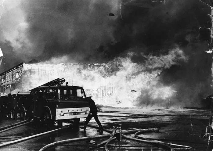
Commonwealth Wool Stores fire 30th September, 1969 From https://m.facebook.com/Igrewupinmortdale2223/photos/a.1594460454117669/2576189425944762/?type=3 with thanks
